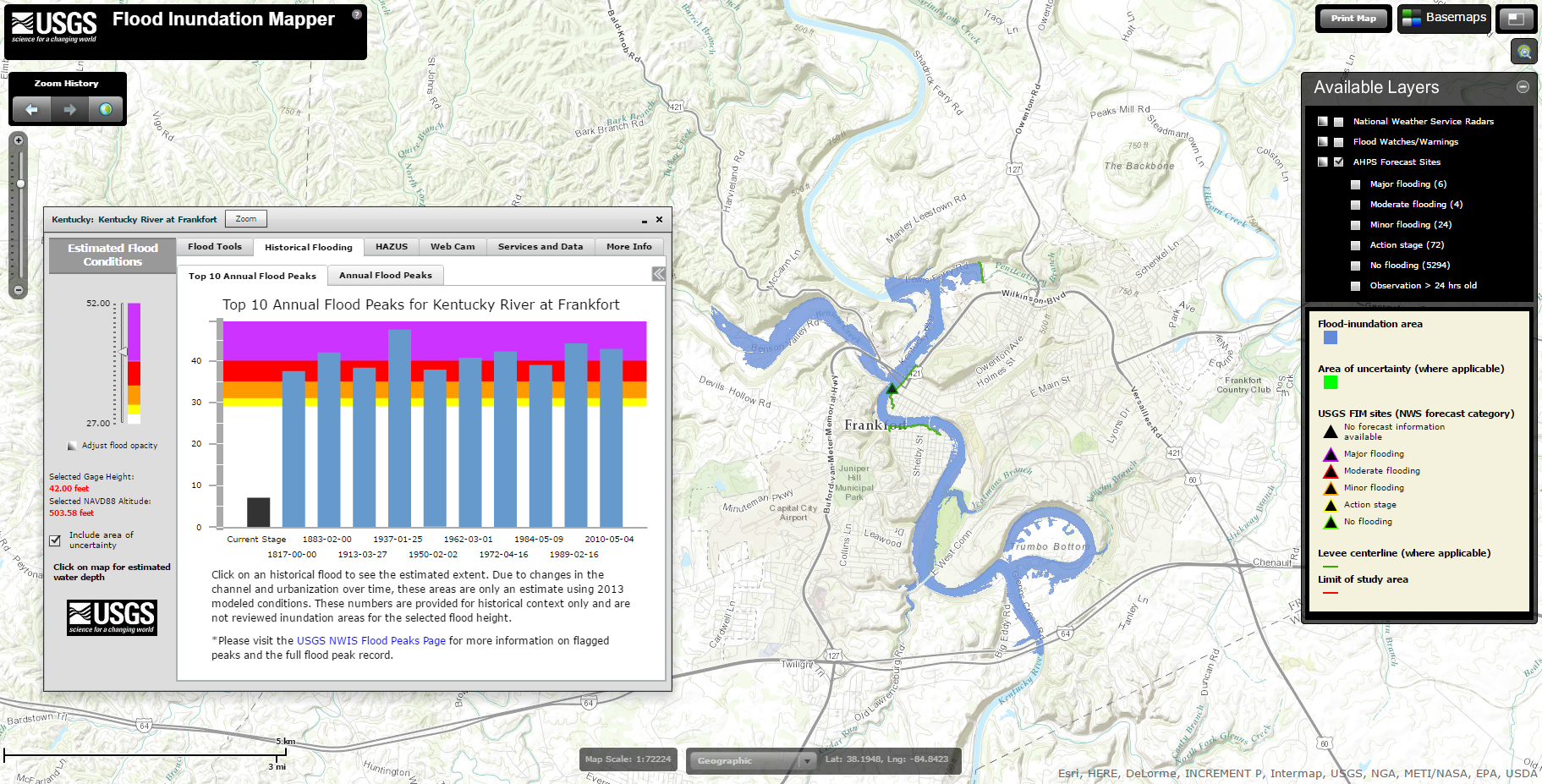
USGS Indiana-Kentucky Water Science Center
Flood Inundation Mapping
Creating a Flood-Inundation Map Library
A FIM library is the collection of high-resolution maps, technical reports, GIS layers, and the online maps (available through the USGS FIM mapper web site) for a particular section, or reach, of a stream or river. Building a FIM library includes
During this phase, we collect information about potential sites including Models are selected for each study. Generally, a one-dimensional step-backwater model developed by the U.S. Army Corps of Engineers is used. Water-surface profiles from the hydraulic model and digital elevation model (DEM) data are combined in ArcGIS, a geographic information system. GIS layers from step 3 are combined with base map layers to form the inundation maps.Phase 1: Site Selection and Data Collection
Phase 2: Data Collection and Modeling

Phase 3: Geospatial Processing
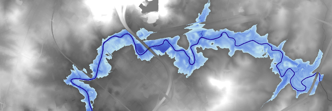
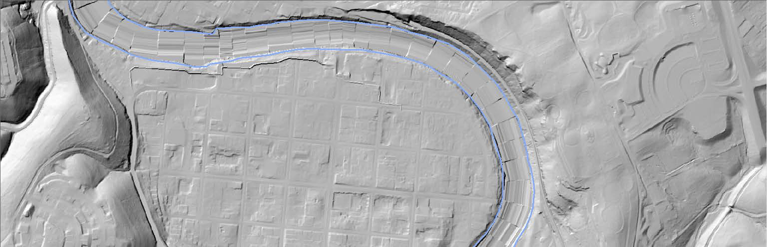
Phase 4: Map Production