| Stream Data: | Gage height, Discharge |
| Water-Quality Data: | Water temperature, specific conductance, pH, dissolved oxygen, turbidity, nitrate plus nitrite |
| Atmospheric Data: | Precipitation, wind speed, wind direction, soil moisture content |
| Latitude: | 39°56'47" |
| Longitude: | 86°15'37" |
| Hydrologic Unit Code (HUC): | 05120201 |
| Datum: | 813.85 feet above NGVD29 |
| Drainage Area: | 106 square miles |
| County in which site is located: | Boone |
| Site managed by: | Indianapolis Office |
This station is operated and maintained in cooperation with the Town of Zionsville, Indiana Department of Natural Resources, and the USGS Groundwater and Streamflow Information Program.


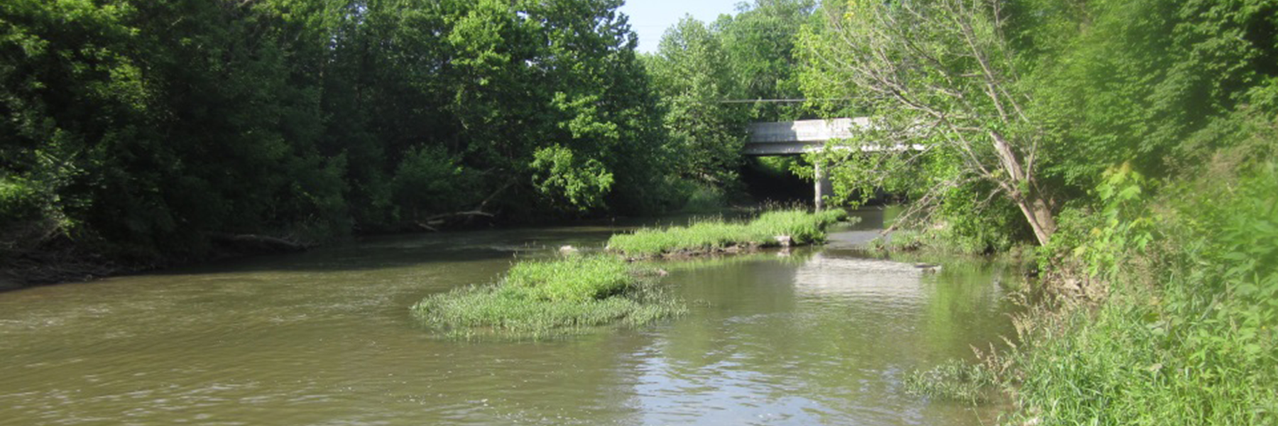
The USGS Eagle Creek at Zionsville, IN water-quality monitoring site is located at Zionsville Road in the town of Zionsville, IN. This site is situated at river mile 24.71 and monitors a drainage area of 106 square miles (210 sq. mi total drainage area). Eagle Creek is a tributary of the White River in central Indiana, and lies in the Central Till Plain physiographic region of Indiana. The surficial geology of this region is characterized by soils mainly consisting of silty clay loam and silt loams. Land use in the headwaters of Eagle Creek is primarily agricultural with increasing urban development as the creek approaches the city of Indianapolis, IN.
The headwaters of Eagle Creek are in Hamilton County. The creek flows southwesterly into Boone County; then southwesterly into Marion County, where it flows into the Eagle Creek Reservoir. Downstream of the reservoir, Eagle Creek flows southeasterly through the city of Indianapolis and into the West Fork of the White River.
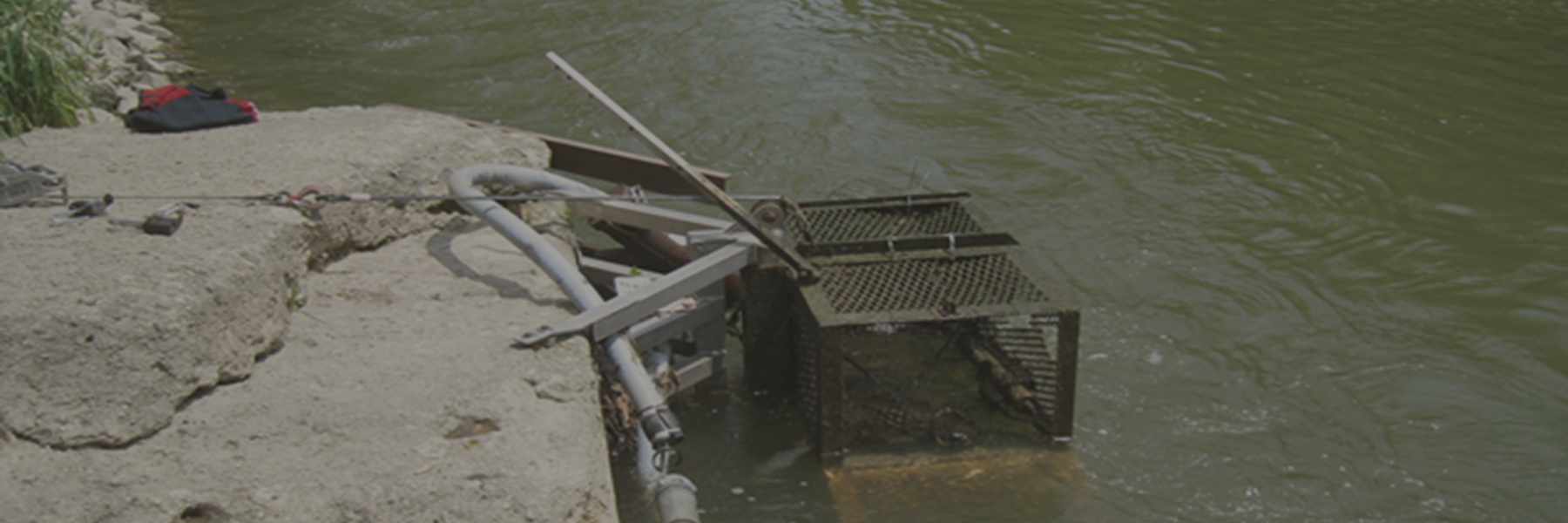
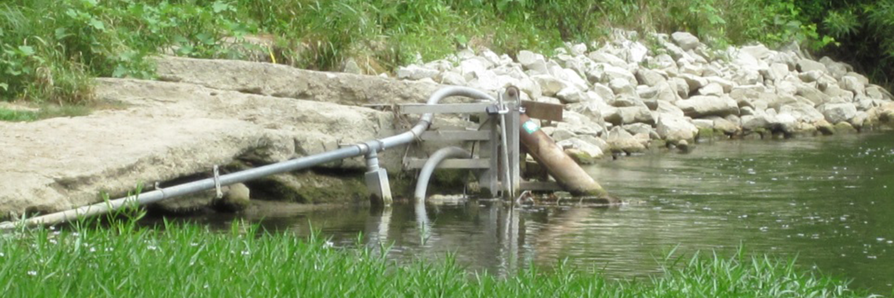
The water-quality gage on Eagle Creek continuously monitors water temperature, pH, specific conductance, dissolved oxygen, turbidity, and nitrate plus nitrite concentrations. Precipitation, wind speed, wind direction, and soil moisture content data are also available at the Zionsville site. Continuously-monitored parameters are measured every 15 minutes, and are transmitted hourly. The data are publicly available on the USGS National Water Information Service (NWIS) web page in real-time.
Discrete samples are collected through a range of hydrologic conditions, and are analyzed for concentrations of nutrients and suspended sediment using protocols outlined in the USGS National Field Manual. Nutrient samples are sent to the USGS National Water Quality Laboratory in Lakewood, Colorado for analysis. Suspended sediment concentration and sand/fine split samples are analyzed at the USGS Kentucky Sediment Laboratory in Louisville, Kentucky. Discrete water-quality samples are typically collected more frequently during the growing season and less frequently during winter months.
Concentrations from laboratory analysis and corresponding values from in-stream instruments are mathematically combined to develop a statistical surrogate model. The model is then used to compute real-time concentrations based on continuous in-stream sensor readings of another, more easily measured value. For example, turbidity is a typical in-stream measurement used as a surrogate for suspended-sediment concentration. Daily, monthly, and annual loads can be computed and compared to understand seasonal and annual variability.
The water quality of Eagle Creek is affected by changes occurring within the watershed. In recent years, the watershed is transitioning to a higher percent urban land use, while management practices of non-urban areas are also in flux. Eagle Creek is the main tributary for Eagle Creek Reservoir, a major drinking water source of Indianapolis. The Town of Zionsville proactively seeks to monitor Eagle Creek and to assess how land use and management practices affect water quality. The water-quality information collected by the USGS addresses this issue by estimating annual and seasonal loads of nutrients and sediment being transported by Eagle Creek to downstream areas in the watershed.

USGS Fact Sheet 2015-3041 provides more detailed information about super gages, how they operate, and the data they collect.
Indiana:
Tim Lathrop
(317) 600-2782
trlathro@usgs.gov
Kentucky:
Jeff Woods
(317) 600-2762
jwoods@usgs.gov